
When you start exploring the world of boating, sailing, or even aviation, you’ll quickly encounter the terms “knots” and “nautical miles.” These are essential units used to measure speed and distance at sea. For those unfamiliar with these concepts, they can seem confusing, so let’s break them down, starting with their origins and meanings.

What Is a Knot?
A knot is a unit of speed used to measure how fast a boat or aircraft is moving. Specifically, one knot is equal to one nautical mile per hour. So, if a boat is traveling at 10 knots, it’s moving at 10 nautical miles per hour.
While modern boats use GPS and instruments to measure speed, the principles remain the same. Knowing your speed in knots helps navigate efficiently, plan your journey, and stay safe on the water.
Why Not Miles Per Hour?
On land, we measure speed in miles per hour (mph) or kilometers per hour (kph), but the ocean operates differently. The Earth’s curvature and how distances are calculated on water align better with nautical miles. Traditional miles (statute miles) are based on fixed distances on land, but on the sea, you need a system that accounts for the Earth’s roundness. Hence, nautical miles and knots make sense for maritime navigation.
What Is a Nautical Mile?
A nautical mile is a unit of distance that is used primarily at sea and in aviation. One nautical mile equals approximately 1.1508 statute (land-measured) miles or about 1.852 kilometers. To put it simply, if a boat is moving at 10 knots, it’s traveling roughly 11.5 miles per hour. More than just a number, using nautical miles gives insight into maritime tradition and nautical precision.
Latitude and Longitude Basics
If you imagine Earth as a giant circle, a nautical mile is one minute of latitude along any line of longitude. This makes nautical miles directly tied to the Earth’s geometry, which ensures precise navigation over long distances. For instance, sailing 60 nautical miles north will move you exactly one degree of latitude. This is because one degree of latitude equals 60 nautical miles.
Latitude and longitude are the coordinate system used to pinpoint locations on Earth, and nautical miles are closely tied to these measurements due to the Earth’s geometry.
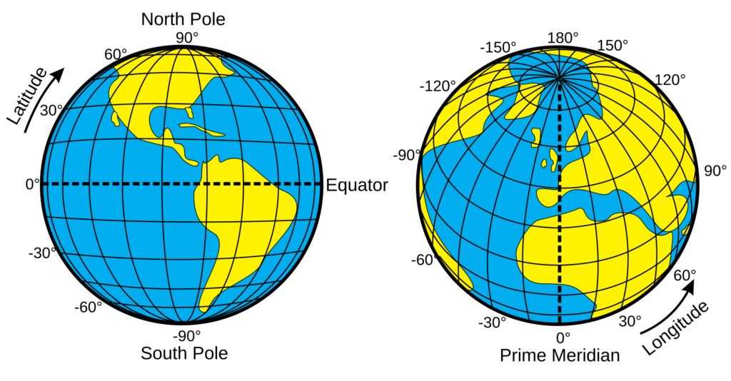
- Latitude refers to the horizontal lines that run parallel to the Equator and measure how far north or south a point is from the Equator. Latitude is measured in degrees (°), with the Equator being 0° and the poles being 90° North or South.
- Longitude refers to the vertical lines that run from the North Pole to the South Pole and measure how far east or west a point is from the Prime Meridian (0° longitude), which passes through Greenwich, England.
Nautical miles are based on the Earth’s circumference, and they are directly linked to the measurement of latitude. The Earth is roughly spherical, and the distance around it can be divided into 360 degrees. Each degree of latitude is further divided into 60 minutes (′), and each minute of latitude corresponds to exactly one nautical mile.
This relationship comes from the fact that the Earth is about 40,075 kilometers (or 21,600 nautical miles) in circumference along a meridian (north-south line). Since there are 360 degrees in a full circle and 60 minutes per degree, that gives a total of 21,600 minutes of latitude. Therefore:
- 1 minute of latitude = 1 nautical mile.
- 1 degree of latitude = 60 minutes = 60 nautical miles.
Why Sailing 60 Nautical Miles Equals 1 Degree of Latitude
If you sail 60 nautical miles north (or south), you are moving across 60 minutes of latitude. Since 1 degree of latitude equals 60 minutes, traveling 60 nautical miles results in moving exactly 1 degree of latitude. If a ship travels at 10 knots, it covers 10 nautical miles in one hour. In six hours, it would travel 60 nautical miles.
This relationship holds true anywhere on Earth because lines of latitude are evenly spaced. Whether you are near the Equator or near the poles, moving 60 nautical miles north or south will always change your latitude by 1 degree. However, longitude lines converge toward the poles, so their spacing varies, and this distance relationship only holds for latitude, not longitude.
In Summary:
- Latitude is key to understanding nautical miles because 1 nautical mile equals 1 minute of latitude.
- Sailing 60 nautical miles north or south changes your position by exactly 1 degree of latitude, due to the consistent spacing of latitude lines on the Earth’s surface.
The Origins of Knots and Nautical Miles
The term “knot” dates back to the days of early seafaring when sailors needed a way to measure their speed. They used a simple, yet clever device called a “chip log.”
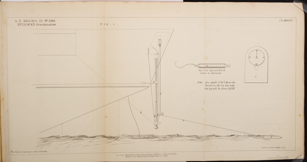
Bullock’ Patent Ship’s Log, for determining the speed of a vessel. Patent No 2599 (1863). Author: Frederick Bullock 1788 – 1874
The Bullock’s Patent Ship’s Log is a mechanical device used to measure the speed of a vessel through water. Invented by Admiral Frederick Bullock (known for his contributions to maritime technology) in the 19th century, it is a type of towed log that consists of a small propeller-like device, called a rotator, attached to the end of a long line that is towed behind the ship.
As the ship moves, the water turns the rotator, and the revolutions are transmitted via the towing line to a mechanism on board, usually a dial, that converts the rotations into a speed reading in knots. By measuring the ship’s speed over time, the log can also help estimate the distance traveled. It was an important tool for navigation before the advent of modern electronic instruments.
The Chip Log Method:
Sailors would throw a wooden board, attached to a rope with evenly spaced knots, over the stern (back) of the ship. The board would float in the water, and as the ship moved, the rope would play out. By counting the number of knots that passed over the side of the ship in a specific amount of time (often 28 seconds), they could estimate the speed of the ship in “knots.” This method was used for centuries and is where the term “knot” originated.
Nautical miles have a history tied to the development of navigation. As sailors explored the world, they needed a unit of distance that aligned with the Earth’s curvature. The nautical mile was established as one minute of arc along a meridian, directly related to the Earth’s geometry, making it essential for accurate navigation.
How to Convert Knots and Nautical Miles
We’ve previously discussed knots as a measure of speed, equal to one nautical mile per hour. Now, let’s look at the nautical mile itself. As mentioned earlier, the nautical mile is a key unit in maritime and aviation settings, tied directly to the Earth’s curvature. Defined as 1,852 meters or roughly 6,076 feet, it’s slightly longer than a standard mile due to its basis on the geometry of the planet (1.1508 statute miles). The nautical mile is derived from the Earth’s geometry, representing the distance of one minute of latitude (1/60th of a degree) along a meridian. This calculation aids in navigation by correlating directly with latitude and longitude.
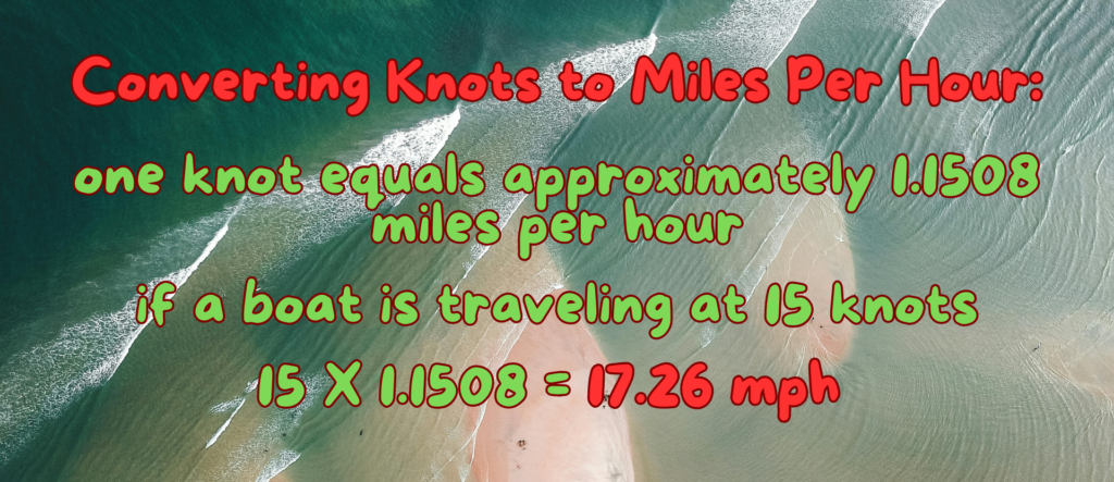
Converting Knots to Miles Per Hour:
Since one knot equals approximately 1.1508 miles per hour, you can convert knots to mph by multiplying the number of knots by 1.1508. For example, if a boat is traveling at 15 knots, it’s moving at approximately 17.26 mph.
Converting Nautical Miles to Statute Miles:
To convert nautical miles to statute miles, multiply the number of nautical miles by 1.1508. For example, 20 nautical miles equals about 23.02 statute miles.
Watch the video for more insights on this topic
Why Knots and Nautical Miles Matter
As mentioned earlier, sailors, pilots, and meteorologists use knots and nautical miles as a universal standard to reflect distances and speeds relevant to Earth’s curved surface. While boats, airplanes, and cars all travel on this curved surface, the key difference lies in the scale and navigation methods. Nautical miles are used in aviation and sailing because these modes cover large distances, making the Earth’s curvature more significant. Pilots and sailors rely on these units because they help ensure accurate navigation over long distances, using spherical geometry and charts based on latitude and longitude.
In contrast, road travel involves much smaller distances where the Earth’s curvature is negligible. For this reason, miles or kilometers are typically used, as roads are mapped on relatively flat surfaces. Using knots and nautical miles at sea or in the air allows for precise journey planning and navigation, essential when traversing the vast and often featureless ocean or sky.
Understanding knots and nautical miles is a fundamental part of grasping how navigation works at sea and in the air. While they may seem complex at first, these units of measurement are deeply tied to the Earth’s shape and the history of seafaring.
By using knots, sailors and pilots can measure speed in a way that directly relates to the distance they travel, allowing for more precise and reliable navigation. Next time you hear a boat’s speed in knots or a distance in nautical miles, you’ll know exactly what it means and why it’s used. Happy Sailing!